Friday 28 December 2012

Afon Llwyd River in Winter, South Wales

Pontnewynydd bridge
The Afon Llwyd translates from Welsh as the silver or pewter river.  It eams with fish and is one of the fastest flowing rivers in South Wales.   Small weirs shimmer in the sunlight, attracting a quantity of dog walkers who park and walk along the riverside paths. 

Silver river, a very apt description for the way it looks today, but in the 1950s I remember it differently.   It was deep brown in colour, and to a child, almost like melted chocolate, but as you approached it was very smelly, not like chocolate at all.    Industrial pollution and sewage were poured into the river along its length without a thought for the damage to wildlife or people's health.

New Inn, near to the river, was the site of the Gas Works with its huge gasometer.   This was also smelly, and as you walked along the footpath there was a wall.   It was the most wonderful wall, full of texture and delicate colours and shapes.   Some pieces were smooth and shiny as glass, others rough and full of burst bubbles.   It was made from clinker, a waste product from the Works, but to me it was beautiful.   My Mother regularly lost patience as her child gazed and groped this wonderful object.

Strange the things we remember !

The Gas Works and smells are long gone, hopefully never to return, but the Silver river survived and still flows to the sea.

Gorged with all the recent rain, it was pewter more than silver in our recent photographs, but still beautiful.


A by-now well-worn clinker wall

 
Much of the sharpness and colour have been worn away


Thursday 20 December 2012

Brecon & Monmouthshire Canal South Wales in Winter

Ice just forming amid the reflections


No fishermen today, but the temperature is freezing or below.   No scraps of bread littering the footpath or floating on the water.  Too cold for the casual walkers who regularly come to feed the wildlife, so the ducks look expectantly as we walk past.   Guilt always grips me on these icy days, that I have nothing for them.


A few years ago I returned from the shop with a loaf of bread bought especially.


I love the bare trees and the reflections they make in the water.  You can almost turn the image upside down and have the same result.


But last year was more picturesque !

Snow in winter 2011

When I was a child the canal iced over so thickly that we could walk on it.  Most years it is only strong enough to hold the balls thrown by dogwalkers with a poor aim, and bottles and cans from the usual litter louts.
 
After years of fighting by local people to preserve this area, progress seemed to be made a few months ago when Torfaen Council removed it from their Development Plan.   Unfortunately a few weeks later Torfaen Council over-turned their decision and this beautiful green belt separating Cwmbran from Sebastopol, is once again at risk.   To think in a few years we could possibly lose all this beauty under housing and tarmac roads, is upsetting.  


Monday 17 December 2012

The Guardian in Winter (South Wales)

If you feel the South Wales Valleys are best viewed during summer weather, perhaps I can try to change your mind.


I recently took a friend to view the Guardian at Six Bells near Abertillery.  The temperature was somewhere around freezing or below.   We wrapped up warmly and turned the heater up in the car on our journey from Ponthir, through Pontypool, Hafodyrynys and Crumlin.


The countryside turned white between Crumlin and Six Bells, not with snow, but with frost.  The freezing fog promised was nowhere to be seen.


Following the brown signs to the Guardian, we turned right down a steep hill to have our first glimpse.   Quickly he disappears and we have to wait until we walk along the path towards him before we have another viewing.

The closer we get, the more impressed my friend becomes.  We brush a thin frost layer from the first information board to read of the colliery disaster at Six Bells.   Further along the pathway, we brush off frost an inch thick to read of the design and structure of the memorial.

This bare-chested miner stands, I am told, as high as the Angel of the North, gazing steadily over the village of Six Bells.   The steel construction weighs 7 tonnes and is surrounded now by parkland, a dipping pond, a fast flowing stream, and a fantastic river walk.

Well worth facing the cold, especially when the Community Cafe awaits with a warm welcoming cup of coffee.

Thursday 13 December 2012

Waterworks Lane, Cwmavon, South wales

 
Waterworks Lane is an unobtrusive turning off the main road at Cwmavon in Torfaen, between Pontypool and Blaenavon.    A reservoir, now derelict, gave rise to the name of the lane, and is situated a short walk along this single track, decorated with fallen leaves and moss.


Water from the reservoir would have been piped for use by the residents of Abersychan and Pontypool. 


A gate at the top of the hill leads to open ground labelled Common Ground by wooden signposts.  Bracken, whimberry bushes and clumps of rushes fight a battle with erosion to cover the barren mountain top.  Where they fail, grey boulders appear, the bones of the earth beneath.


Devil's Heap of Stones
At this time of year Lasgarn Wood looks particularly colourful.  Below the woodland to our left vehicles make their way to and from Blaenavon, unaware of being observed.   We follow the mountain track to a farm gate, then vere right across open ground to encounter the "Devil's Heap of Stones."   The earth's bare bones piled high.


As we turn, the sun lies low in the sky.   It reflects silver on the water trickling along the tracks.


Passing fields of  luscious rain-sodden grass, we continue down the lane.  Sheep graze quietly, but unwittingly we disturb the neighbourhood dogs.  The valley echoes to the barking of hounds ready to tear us limb from limb, or great us with wagging tails and slathering tongues.

A small car park helps relieve this single track of traffic congestion.  Its damp in this little valley so moss grows freely.   A narrow stone bridge leads back to the main road and shopping.


Friday 23 November 2012

Cardiff Castle, South Wales

 
Tunnel inside the castle perimeter wall
Although Cardiff Castle has parts which date back to the Romans, it must thank the Marquis of Bute and the 19th century architect and designer William Burgess for its sumptuous interiors.  The Bute family's riches were derived from the coal and iron industry and Cardiff port, and the current Marquis lives on the Isle of Bute in Scotland.  

Sections of the outer wall have the remains of the early Roman structure highlighted.   These areas are easily visible from the road outside the castle, althought the moat has now been grassed over.
 
Visitors can walk through an 'invisible' tunnel built into the castle perimeter wall.  It has windows out onto the Cardiff city shoppers.  During WWII it was used as a bomb shelter.  Inside the castle grounds it is covered by an earth bank, making it invisible to those unaware of its existence.

The castle has many interesting aspects, including the motte and bailey which the energetic can scale by a flight of stairs.

Demon above doorway to scare servants from eavesdropping


The servants' quarters, although not on the general tour, have a magnificent vaulted ceiling.  A fantastic room for ghost stories or just absorbing the atmosphere.


The bare stonework, however, contrasts with the lavish decorations applied upstairs to their master's quarters.


The castle is well worth a visit, but situated in the centre of Cardiff it has no parking facilities for visitors, and as it is still owned by the current Marquis of Bute, unlike other museums in the area, there is an entry charge.   Guided tours of the house take place regularly, and there is a tea-room and grounds to enjoy during the summer months.


Monday 19 November 2012

Ynysfach Iron works, Dowlais Engine House, Merthyr


Engine House Floodlit
Ynysfach Engine House, Dowlaid, Merthyr

Copyright of:  http://www.mtht.co.uk/Ynysfachopening.html

Ynysfach Ironworks, Merthyr Tydfil was built by Thomas Jones of Merthyr Tydfil.   Watkin George designed the building and it was built for Richard Crawshay in 1801.

These furnaces were the second in Merthyr Tydfil to have steam-powered air blast machinery, giving the works an advantage over the nearby Cyfarthfa Ironworks, which depended on water power.

Two more blast furnaces and a new southern, engine house were built in 1830 when the northern engine house was rebuilt.

Reconditioning took place in 1884, after closure in 1873.   The Ynysfach furnaces were  then held in reserve, following Cyfarthfa’s conversion to steel.

The southern engine house was demolished some time after 1905 and one chimney stack (belonging to the northern boiler house) was demolished in 1949.


It is now the home of Pant and Dowlais Boys and Girls Club, reknowned for its work with the youth of the area.  Check out the dowlais engine house website below for details of current events.  Some  are designed for adults too, and volunteers are always wanted.


http://www.gracesguide.co.uk/Ynysfach_Ironworks

http://www.dowlaisenginehouse.co.uk/

http://www.ggat.org.uk/news/archive/merthyr_college/news.html

Friday 26 October 2012

Gelligaer Common, South Wales in October

Shrouded in cloud and fog, Gelligaer Common insisted on hiding its secrets and much of its mystery this week.  


After walking across an exposed, waterlogged landscape, we were asked to imagine ancient tribes erecting the Cefn Stone at the entrance to their settlement.   With no food or healthy drinking water or even building materials in sight, it is difficult to believe.


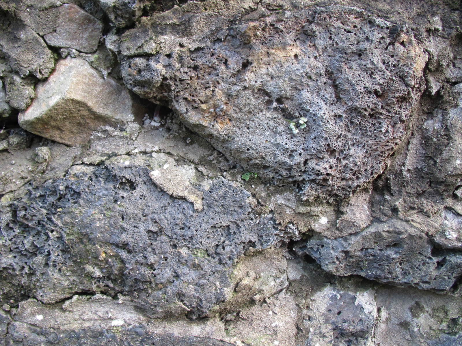
Standing on the bleak mountainside alone, it remains the only marker of this possibly bronze age homestead.   The stone now rests at an angle of almost 45 deg. due, we are told, to failed attempts by historians in the 18th or 19th century to excavate its secrets.

Out of the mist, a lone off-road cyclist scurries past, watched by sheep and horses who gaze with little interest.   Soon the object of their gaze will become the subject of a 'Helicopter Heroes,' episode, unless he is very well aquainted with his route across this pockmarked landscape.


A little way away, the cloud still masks the mountain, but Capel Gwladys slowly appears.   A standing stone carved with celtic basket weave (probably about 30 years old,) marks the spot of a church established Circa 430AD.


As our walking group approaches up the slope, we could have been following the path of worshippers from two thousand years earlier.   Although in these weather conditions, this appears a relatively isolated, peaceful spot, for a Christian Church to have been built here would have required quite a large and dedicated congregation.

Is it here she died?
Is it here she lies,
Gwladys.
Shrouded in mist,
buried in time,
this Celtic Princess.
Tales retold
memories reborn.
A million faces
shine through the mist
trying to see history,
to see Gwladys.


Bank of Roman Stockade
Remaining bank from Roman Stockade
David, our Leader, explained how Roman Soldiers were expected to march out of camp and build a stockade to spend the night before returning.  


Originally a formidable structure, surrounded by an earth bank within a ditch, dug four feet deep, and topped with wooden stakes it would have been patrolled by Roman guards.    The remains of the stockade, gently sloping grassy mounds, are pointed out to the unwary observer, and lie invisible from the roadway.


Amid much talk of ghosts, I wonder how would those soldiers have felt, digging these trenches after marching all day, each carrying a full pack including wooden stakes.


Its difficult for us to imagine these men working and camping here and achieving so much.   But did they ever think their work would be inspected in the twentieth century?  


These soldiers in thonged leather sandals, tunics and hand-tooled metal helmets would never have believed that people wearing  man-made fibres, and waterproof Gore-Tex Boots would be recording the remains of their work using digital cameras, phones and Ipads and then clambering into a purple diesel-engined coach.

My first visit to Gelligaer Common, despite the fog and low cloud, has been truly inspirational.  

Thursday 25 October 2012

Blaenavon Mountain & Keepers Pond

The heritage town of Blaenavon lies as the head of the Eastern Valley.   Its prosperity in the nineteenth century was mainly due to the mountain slopes above the town, rich in both iron and coal.   Much of the industrial landscape is disappearing, but can still be seen by the observant onlooker.  

The autumn sun on the black slag heaps reveal deep ridges imposed by running water and weathering.    Many large bowl-shaped indentations which offer shelter for grazing sheep, are the result of early mining.    Now covered mainly in heather and whimberry bushes these dips were once bell-pits which have now collapsed in on themselves.   This mountain is located on the eastern rim of the South Wales Coalfield.   A miner could dig a hole and collect coal from just under the surface soil.  Gradually the hole would become deeper and wider as more coal was removed.   Without any support for the roof of this bell-pit it would eventually collapse, forming a bowl-shaped indentation.

The Keepers Pond,  was constructed as a feeder pond for local industry.   Now people enjoy the scenery, and perhaps sail model boats on the pond.   There are many walks around the area.   Colonel Llewelly, an avid showjumping champion in the1950s with his horse Foxhunter.   When the horse died his owner buried him on the mountain, just a short walk away, and a plaque identifies the horses burial place.

On a clear day, hang-gliders can be seen launching themselves from the steep slopes and enjoying the thermals above Gilwern.

Car drivers need care as sheep wander this Common land without any Highway Code training.   They often sleep in the road or unpredictably cross over to be with friends.   This can result in an expensive encounter for an unwitting car or van driver.


Keen eyes may spot the previously mentioned delicious whimberries amongst the ground cover.  Similar in appearance to blueberries, they taste good in pies or just with cream.   Many locals have their own secret spot for picking, where they claim the whimberries grow the size of walnuts.   You may doubt this, unless you can find someone willing to show you where...


Pen-y-Fan Pond, Manmoel, South Wales


Pen-y-Fan Pond gleams in the sunshine.   Its surrounded by the golden tints of autumn, but still enjoyed by families taking a walk around the perimeter and perhaps exercising their dogs.   Both children and dogs can run free but still be within sight of parents and owners.  Care is needed, though, as the pond is unfenced.
After this very wet summer there are many streams and marshy areas, so sturdy footwear is required, unless you intend to remain on the tarmac pathway.

Despite being within stone-throwing distance of Pen-y-Fan Inedustrial Park, this Countryside Park is surrounded by fields and trees.

As you approach the pond from the car park area, a notice on the toilet block advises they are only open April till September 10am-5pm.   The park is pleasantly full today and its 14th October !! 

Pen-y-Fan Pond was created a country park in 1976, and is used for fishing, sailing and canoeing.

'Machines' along the Alien Invasion Trail
An 'Alien Invasion Trail' footpath around the pond keeps children's interest, allowing parents to enjoy the Manmoel countryside. The alien signposts are now showing extreme wear and vandalism, but their original intention to provide education on local wildlife in an interesting way, can still be understood and hopefully explained by interested parents.  But the adventure of trying to find the next amid the undergrowth still remains.
Kissing Gate towards Trinant

A little further along the path a small pathway leads off to a kissing gate.   Go through the gate and cross the road to a small lane.   Bear left and it will lead down over a slope to Trinant village.   Turn left at the bottom and follow the road around to find Pentwyn Inn - with an open area in front and several benches outside.

The best and last complete example of a canal feeder reservoir in South Wales, this pond was created in 1745.   It served as feeder pond for the Crumlin arm of the Monmouthshire Canal until the 1850s, when the canal was replaced by rail.    Trains was far more efficient for carrying coal and iron to the port of Newport for transfer along the river Severn and its estuary, or for export.


The Country Park was Part funded by the Welsh Assembly Government.
Further information from Planning@Caerphilly.Gov.Uk
Tel: 01495 235219